MATTERPORT PRO3
Professional 3D spatial digitisation indoors and outdoors
LiDAR-alapú térfelmérés, vizuális dokumentáció és digitális ikrek készítése egy professzionális, hordozható rendszerrel.
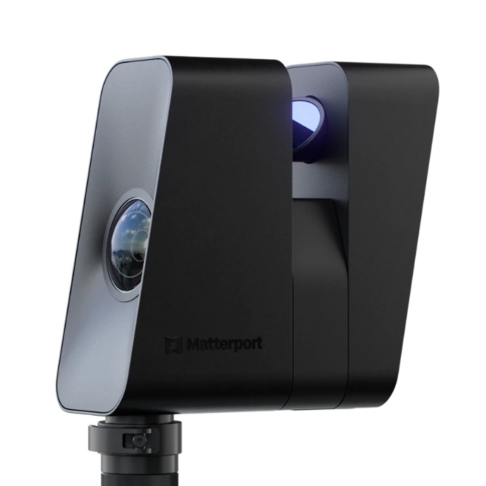
What is the Matterport Pro3 used for?
The Matterport Pro3 is designed for tasks that require fast, detailed, and visually usable 3D spatial documentation.
Building survey
Digital documentation of existing buildings before renovation, conversion, or operation.
Digital twin
Creating an interactive, walkable digital space for documentation, planning, and presentation purposes.
Construction documentation
Recording the various states of construction and the ability to revisit the site later.
Industrial facilities
Detailed digital documentation of manufacturing areas, production halls, and technology spaces for operational, planning, and surveying purposes.
Outdoor survey
3D recording of the external environment, facades, and related areas of buildings for outdoor workflows.
Property and presentation
Spectacular, walkable digital space for the professional presentation of properties, showrooms, tourist and business locations.
Miért Matterport Pro3?
The Pro3 combines the capture of 3D spatial data, visual documentation, and the advantages of the Matterport digital twin platform in a single system.
LiDAR technológia
Térbeli adatok gyors és részletes rögzítése professzionális 3D dokumentációhoz.
Beltéren és kültéren
A Pro3 nemcsak belső terek, hanem épületek külső környezetének és nagyobb helyszíneknek a dokumentálására is használható.
Gyors helyszíni munkavégzés
A helyszín digitális rögzítése hatékonyan elvégezhető, így csökkenthető a felméréshez szükséges helyszíni idő.
Digitális iker egy rendszerben
A rögzített adatokból bejárható, mérhető és megosztható digitális tér hozható létre a Matterport platformon.
Műszaki adatok
A Matterport Pro3 professzionális LiDAR-technológiát és nagy felbontású képalkotást kombinál gyors, beltéri és kültéri 3D felméréshez.
| Feature | Value |
|---|---|
| Depth sensing | LiDAR |
| Accuracy | ±20 mm @ 10 m |
| Field of view | 360° horizontal / 295° vertical |
| Depth resolution | 100,000 points/sec, up to 1.5 million points/scan |
| Measurement range | from 0.5 m, up to 100 m in the case of E57 |
| Scanning time | < 20 sec / position |
| Panorama | 134.2 MP |
| Weight | 2.2 kg |
| Battery | more than 220 consecutive scans |
| Protection | IP43 |
| Operating temperature | 0–40 °C |
Own Matterport Pro3 or survey as a service?
It is not necessary to purchase your own device for every project. Reverto-Global makes the Matterport Pro3 technology available as both a device and a professional surveying service.
Acquisition of Matterport Pro3
Own system for businesses and professionals who regularly conduct 3D surveys, documentation, or create digital twins.
- own device and continuous availability
- for regular surveying tasks
- assistance in selecting the right configuration
3D survey as a service
If professional 3D surveying is only needed for a specific project, Reverto-Global will carry out the on-site data collection and create the digital space.
- no need for equipment investment
- on-site survey with our own Pro3 system
- ready digital twin and documentation