Zum Inhalt springen
Reverto-Global · 3D és téradat-megoldásokReverto-Global · 3D and spatial data solutionsReverto-Global · 3D- und GeodatenlösungenReverto-Global · 3D a priestorové dátové riešenia

3D és téradat-megoldások a valós környezet pontos megértéséhez3D and spatial data solutions for a clearer understanding of real-world environments3D- und Geodatenlösungen für ein präzises Verständnis der realen Umgebung3D a priestorové dátové riešenia pre lepšie pochopenie skutočného prostredia

A helyszín, a kívánt részletesség és a felhasználási cél alapján választjuk ki a megfelelő adatgyűjtési és feldolgozási technológiát. A cél nem pusztán adatot gyűjteni, hanem használható digitális eredményt átadni.We select the appropriate capture and processing technology based on the site, required level of detail and intended use. The goal is not simply to collect data, but to deliver a usable digital result.Wir wählen die geeignete Erfassungs- und Verarbeitungstechnologie anhand des Standorts, der erforderlichen Detailtiefe und des Verwendungszwecks. Unser Ziel ist es, nicht nur Daten zu erfassen, sondern nutzbare digitale Ergebnisse zu liefern.Vhodnú technológiu zberu a spracovania údajov vyberáme podľa lokality, požadovanej podrobnosti a účelu využitia. Naším cieľom nie je iba získavať údaje, ale odovzdávať použiteľné digitálne výstupy.

3D and spatial data capture
A megközelítésünkOur approachUnser AnsatzNáš prístup

A technológiát mindig a projekt céljához választjukTechnology selected around the project objectiveTechnologie passend zum ProjektzielTechnológia prispôsobená cieľu projektu

Site-specific data capture

Helyszínhez igazított adatgyűjtésSite-specific data captureStandortgerechte DatenerfassungZber údajov prispôsobený lokalite

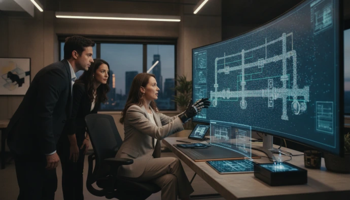
A környezet, a szükséges pontosság és a további felhasználás alapján választjuk ki a megfelelő mérési módszert.The capture method is selected according to the environment, required accuracy and intended downstream use.Wir wählen die Messmethode anhand der Umgebung, der erforderlichen Genauigkeit und der späteren Verwendung aus.Metódu merania vyberáme podľa prostredia, požadovanej presnosti a následného využitia údajov.

Processed usable result

Feldolgozott, használható eredményProcessed, usable resultsAufbereitete, nutzbare ErgebnisseSpracované, použiteľné výsledky

A projekt igénye szerint pontfelhőt, modellt, dokumentációt, virtuális teret vagy digitális felületet adunk át.Depending on the project, we deliver point clouds, models, documentation, virtual spaces or digital interfaces.Je nach Projekt liefern wir Punktwolken, Modelle, Dokumentation, virtuelle Räume oder digitale Anwendungen.Podľa potrieb projektu odovzdávame mračná bodov, modely, dokumentáciu, virtuálne priestory alebo digitálne aplikácie.

Project-specific digital solution

A projekt céljához igazított megoldásSolution aligned with the project goalEine Lösung für das jeweilige ProjektzielRiešenie prispôsobené cieľu projektu

Az eredményeket szükség esetén meglévő műszaki, üzemeltetési, értékesítési vagy döntéstámogató folyamatokhoz illesztjük.Where needed, results are aligned with existing technical, operational, sales or decision-support processes.Bei Bedarf integrieren wir die Ergebnisse in bestehende technische, betriebliche, vertriebliche oder entscheidungsunterstützende Prozesse.Podľa potreby začleňujeme výsledky do existujúcich technických, prevádzkových, obchodných alebo rozhodovacích procesov.

Miben segíthetünk?How can we help?Wie können wir Ihnen helfen?Ako vám môžeme pomôcť?

Fő szolgáltatási területeinkOur main service areasUnsere wichtigsten LeistungsbereicheNaše hlavné oblasti služieb

A különböző technológiákat önállóan vagy egymással kombinálva alkalmazzuk, a projekt tényleges információigényéhez igazodva.We use these technologies independently or in combination, depending on the information the project actually requires.Wir setzen unterschiedliche Technologien einzeln oder kombiniert ein – entsprechend dem tatsächlichen Informationsbedarf des Projekts.Rôzne technológie využívame samostatne alebo ich kombinujeme podľa skutočných informačných potrieb projektu.

3D digitization and virtual spaces
01 · Szolgáltatási területService areaLeistungsbereichOblasť služieb

3D digitalizáció és virtuális terek3D digitization and virtual spaces3D-Digitalisierung und virtuelle Räume3D digitalizácia a virtuálne priestory

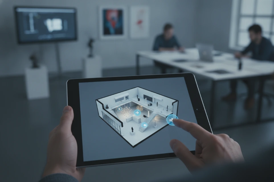
Épületek, ipari környezetek, bemutatótermek, szálláshelyek és kulturális helyszínek digitális leképezése. Az interaktív 3D tér távolról is bejárható, bemutatható és dokumentációként is használható.Digital capture of buildings, industrial environments, showrooms, accommodation and cultural sites. The resulting interactive 3D space can be explored remotely, presented online and used as visual documentation.Digitale Erfassung von Gebäuden, Industrieanlagen, Showrooms, Unterkünften und Kulturstätten. Der interaktive 3D-Raum lässt sich aus der Ferne begehen, online präsentieren und als visuelle Dokumentation nutzen.Digitálne zachytávanie budov, priemyselných priestorov, showroomov, ubytovacích zariadení a kultúrnych pamiatok. Výsledný interaktívny 3D priestor možno preskúmať na diaľku, prezentovať online a využiť na vizuálnu dokumentáciu.

Mire használható?Typical applicationsTypische AnwendungenTypické využitie
  • virtuális ingatlan- és helyszínbemutatásvirtual property and site presentationvirtuelle Präsentation von Immobilien und Standortenvirtuálna prezentácia nehnuteľností a lokalít
  • ipari és műszaki térdokumentációindustrial and technical spatial documentationräumliche Dokumentation von Industrieanlagen und technischen Bereichenpriestorová dokumentácia priemyselných a technických objektov
  • digitális bemutatótermekdigital showroomsdigitale Showroomsdigitálne showroomy
  • oktatási és tréningkörnyezetektraining and learning environmentsSchulungs- und Lernumgebungenškoliace a vzdelávacie prostredia
  • műemlékek és kulturális értékek online bemutatásaonline presentation of heritage and cultural sitesOnline-Präsentation von Denkmälern und Kulturstättenonline prezentácia pamiatok a kultúrnych lokalít
  • Google Street View-megjelenés frissítéseGoogle Street View presence updatesAktualisierung der Google-Street-View-Präsenzaktualizácia zobrazenia v Google Street View
Lehetséges eredményekTypical deliverablesMögliche ErgebnisseMožné výstupy

Interaktív virtuális bejárás · 360° panorámaképek · alaprajzi nézet · vizuális helyszíndokumentáció · beágyazható online bemutatóInteractive virtual tour · 360° panoramas · floor-plan view · visual site documentation · embeddable online presentationInteraktiver virtueller Rundgang · 360°-Panoramen · Grundrissansicht · visuelle Standortdokumentation · einbettbare Online-PräsentationInteraktívna virtuálna prehliadka · 360° panorámy · pôdorysný pohľad · vizuálna dokumentácia lokality · vložiteľná online prezentácia

Virtuális séta részletekExplore virtual toursMehr zu virtuellen RundgängenViac o virtuálnych prehliadkach
Drone surveying and photogrammetry
02 · Szolgáltatási területService areaLeistungsbereichOblasť služieb

Drónos felmérés és fotogrammetriaDrone surveying and photogrammetryDrohnenvermessung und PhotogrammetrieZameriavanie dronmi a fotogrametria

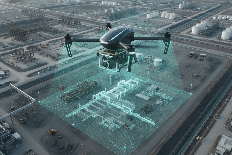
Légi adatgyűjtés épületek, ipari területek, beruházások és nagyobb helyszínek dokumentálására. A felvételekből vizuális dokumentáció, ortofotó, pontfelhő vagy 3D felületmodell készíthető.Aerial data capture for buildings, industrial areas, construction projects and larger sites. The imagery can be processed into visual documentation, orthophotos, point clouds or 3D surface models.Luftgestützte Datenerfassung zur Dokumentation von Gebäuden, Industrieflächen, Bauprojekten und größeren Standorten. Aus den Aufnahmen lassen sich visuelle Dokumentationen, Orthofotos, Punktwolken oder 3D-Oberflächenmodelle erstellen.Letecký zber údajov na dokumentáciu budov, priemyselných areálov, stavebných projektov a rozsiahlejších lokalít. Zo snímok možno vytvoriť vizuálnu dokumentáciu, ortofotomapy, mračná bodov alebo 3D modely povrchu.

Mire használható?Typical applicationsTypische AnwendungenTypické využitie
  • tetők és épületszerkezetek állapotának dokumentálásadocumentation of roofs and building structuresZustandsdokumentation von Dächern und Gebäudekonstruktionendokumentácia stavu striech a stavebných konštrukcií
  • kivitelezések előrehaladásának követéseconstruction progress monitoringÜberwachung des Baufortschrittssledovanie postupu výstavby
  • ipari területek áttekintéseoverview of industrial sitesÜberblick über Industrieflächenprehľad priemyselných areálov
  • nehezen hozzáférhető helyszínek vizsgálatainspection of difficult-to-access locationsInspektion schwer zugänglicher Standortekontrola ťažko prístupných miest
  • terület- és objektumdokumentációsite and object documentationDokumentation von Flächen und Objektendokumentácia území a objektov
  • fotogrammetriai 3D modellek készítésecreation of photogrammetric 3D modelsErstellung photogrammetrischer 3D-Modelletvorba fotogrametrických 3D modelov
Lehetséges eredményekTypical deliverablesMögliche ErgebnisseMožné výstupy

Nagy felbontású légi felvételek · ortofotó · 3D felületmodell · fotogrammetriai pontfelhő · állapotkövetési dokumentációHigh-resolution aerial imagery · orthophoto · 3D surface model · photogrammetric point cloud · progress documentationHochauflösende Luftaufnahmen · Orthofoto · 3D-Oberflächenmodell · photogrammetrische Punktwolke · Dokumentation des ProjektfortschrittsLetecké snímky s vysokým rozlíšením · ortofotomapa · 3D model povrchu · fotogrametrické mračno bodov · dokumentácia priebehu projektu
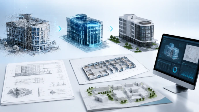
LiDAR, laser scanning and point clouds
03 · Szolgáltatási területService areaLeistungsbereichOblasť služieb

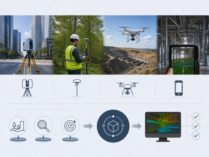
LiDAR, lézerszkennelés és pontfelhőLiDAR, laser scanning and point cloudsLiDAR, Laserscanning und PunktwolkenLiDAR, laserové skenovanie a mračná bodov

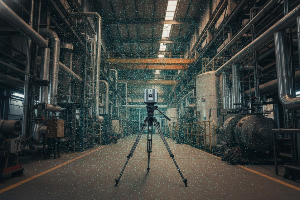
Nagy részletességű háromdimenziós téradat épületekről, ipari létesítményekről és összetett környezetekről. A regisztrált pontfelhő megbízható digitális alapot ad további modellezési és dokumentációs feladatokhoz.High-detail three-dimensional spatial data for buildings, industrial facilities and complex environments. A registered point cloud provides a robust digital basis for further modelling and documentation.Detaillierte dreidimensionale Geodaten von Gebäuden, Industrieanlagen und komplexen Umgebungen. Eine registrierte Punktwolke bietet eine verlässliche digitale Grundlage für weitere Modellierungs- und Dokumentationsaufgaben.Podrobné trojrozmerné priestorové údaje o budovách, priemyselných objektoch a zložitých prostrediach. Registrované mračno bodov poskytuje spoľahlivý digitálny podklad na ďalšie modelovanie a dokumentáciu.

Mire használható?Typical applicationsTypische AnwendungenTypické využitie
  • meglévő állapot digitális rögzítésedigital capture of existing conditionsdigitale Bestandsaufnahmedigitálne zachytenie existujúceho stavu
  • ipari csarnokok és gépészeti környezetek felmérésesurvey of industrial halls and mechanical environmentsVermessung von Industriehallen und technischen Anlagenzameriavanie priemyselných hál a technických priestorov
  • homlokzatok és épületszerkezetek dokumentálásadocumentation of façades and structuresDokumentation von Fassaden und Gebäudekonstruktionendokumentácia fasád a stavebných konštrukcií
  • tervezést megelőző adatgyűjtéspre-design data acquisitionDatenerfassung vor der Planungsphasezber údajov pred projektovaním
  • metszetek és méretezhető nézetek előállításacreation of sections and measurable viewsErstellung von Schnitten und messbaren Ansichtentvorba rezov a merateľných pohľadov
  • BIM- és CAD-modellezés előkészítésepreparation for BIM and CAD modellingVorbereitung der BIM- und CAD-Modellierungpríprava BIM a CAD modelovania
Lehetséges eredményekTypical deliverablesMögliche ErgebnisseMožné výstupy

Regisztrált pontfelhő · E57, LAS vagy egyeztetett formátum · metszetek · méretezhető nézetek · 3D hálómodell · modellezési alapadatRegistered point cloud · E57, LAS or agreed format · sections · measurable views · 3D mesh · modelling source dataRegistrierte Punktwolke · E57, LAS oder vereinbartes Format · Schnitte · messbare Ansichten · 3D-Netzmodell · Ausgangsdaten für die ModellierungRegistrované mračno bodov · E57, LAS alebo dohodnutý formát · rezy · merateľné pohľady · 3D sieťový model · podkladové údaje na modelovanie

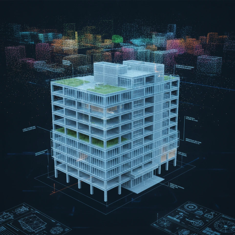
BIM and 3D modelling
04 · Szolgáltatási területService areaLeistungsbereichOblasť služieb

BIM és 3D modellezésBIM and 3D modellingBIM und 3D-ModellierungBIM a 3D modelovanie

Helyszíni felmérésekből és pontfelhőkből a projekt céljához igazított digitális épület- és objektummodelleket készítünk. A modellek a tervezés, átalakítás, üzemeltetés és hosszú távú dokumentálás munkafolyamatait támogatják.We turn survey data and point clouds into project-specific digital building and object models. These models support design, refurbishment, facility management and long-term documentation workflows.Aus Vermessungsdaten und Punktwolken erstellen wir projektbezogene digitale Gebäude- und Objektmodelle. Die Modelle unterstützen Planung, Umbau, Gebäudebetrieb und langfristige Dokumentation.Z údajov z terénneho zameriavania a mračien bodov vytvárame digitálne modely budov a objektov prispôsobené projektu. Modely podporujú projektovanie, prestavby, správu budov a dlhodobú dokumentáciu.

Mire használható?Typical applicationsTypische AnwendungenTypické využitie
  • meglévő állapot modellezéseas-built modellingBestandsmodellierungmodelovanie existujúceho stavu
  • pontfelhőből készülő BIM-modellBIM models from point cloudsBIM-Modelle aus PunktwolkenBIM modely z mračien bodov
  • építészeti és szerkezeti elemek feldolgozásaprocessing of architectural and structural elementsModellierung architektonischer und konstruktiver Elementespracovanie architektonických a konštrukčných prvkov
  • egyszerűsített tér- és tömegmodelleksimplified spatial and massing modelsvereinfachte Raum- und Volumenmodellezjednodušené priestorové a objemové modely
  • műszaki vizualizációtechnical visualizationtechnische Visualisierungtechnická vizualizácia
  • modellalapú dokumentációmodel-based documentationmodellbasierte Dokumentationdokumentácia založená na modeli
Lehetséges eredményekTypical deliverablesMögliche ErgebnisseMožné výstupy

A részletezettséget, információtartalmat és átadási formátumot minden projekt esetében a tényleges felhasználási célhoz igazítjuk.Model detail, information content and delivery format are defined for each project according to the intended use.Modelldetaillierung, Informationsgehalt und Lieferformat werden bei jedem Projekt auf die tatsächliche Nutzung abgestimmt.Podrobnosť modelu, informačný obsah a formát odovzdania pri každom projekte prispôsobujeme skutočnému účelu využitia.

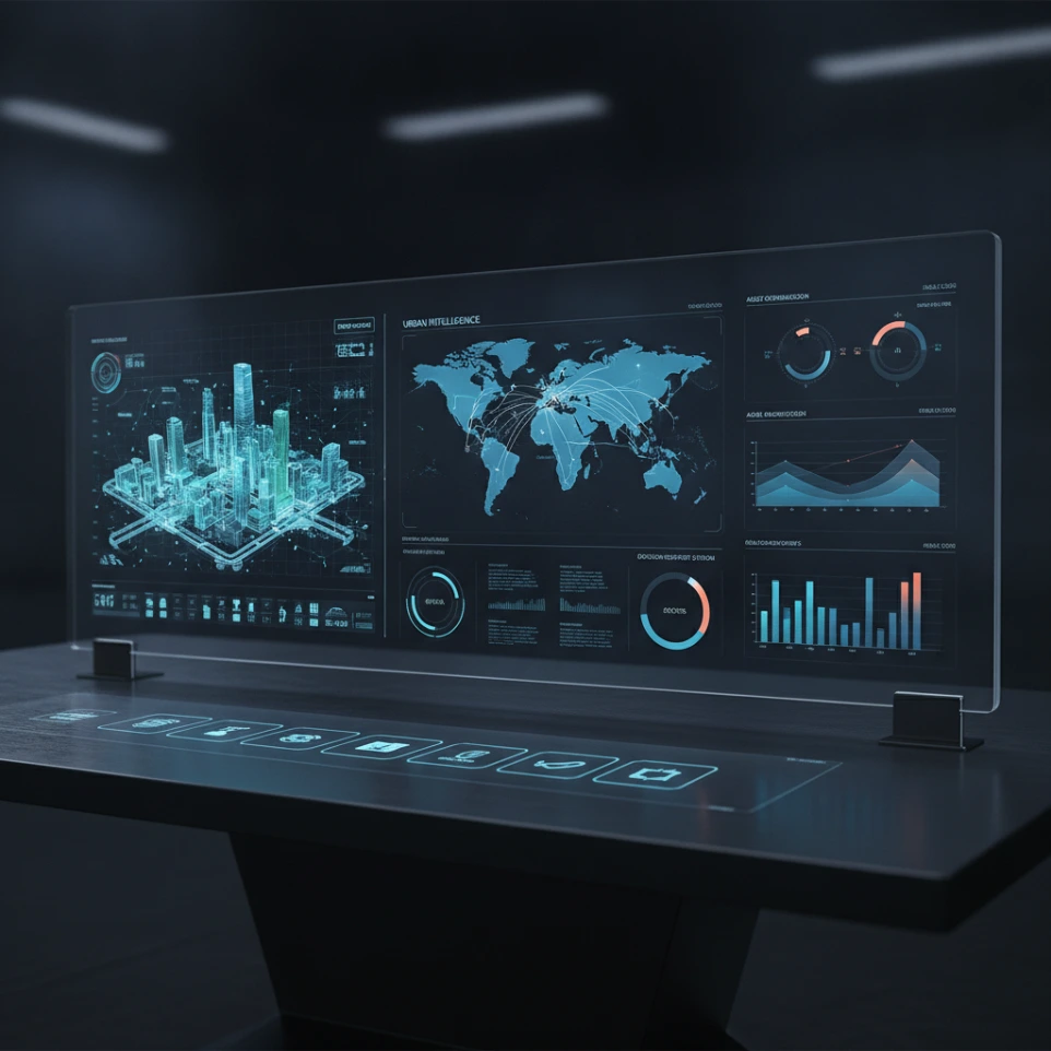
Spatial data and digital solutions
05 · Szolgáltatási területService areaLeistungsbereichOblasť služieb

Téradat- és digitális megoldásokSpatial data and digital solutionsGeodaten und digitale LösungenPriestorové údaje a digitálne riešenia

A felmérési adatok akkor teremtenek valódi értéket, ha áttekinthetően megjeleníthetők, összehasonlíthatók és beépíthetők a műszaki vagy üzleti folyamatokba. Ehhez projekt-specifikus digitális megjelenítési és döntéstámogató megoldásokat alakítunk ki.Survey data creates the most value when it can be clearly visualized, compared and integrated into technical or business processes. We build project-specific digital presentation and decision-support solutions around the available data.Vermessungsdaten schaffen den größten Mehrwert, wenn sie übersichtlich dargestellt, verglichen und in technische oder betriebliche Prozesse integriert werden können. Dafür entwickeln wir projektspezifische digitale Visualisierungs- und Entscheidungshilfen.Údaje zo zameriavania prinášajú najväčšiu hodnotu, keď ich možno prehľadne zobraziť, porovnávať a integrovať do technických alebo obchodných procesov. Na tomto základe vytvárame digitálne vizualizačné a rozhodovacie riešenia prispôsobené projektu.

Mire használható?Typical applicationsTypische AnwendungenTypické využitie
  • téradatok rendszerezése és vizualizációjaorganization and visualization of spatial dataStrukturierung und Visualisierung von Geodatenorganizácia a vizualizácia priestorových údajov
  • webes térképi és 3D megjelenítésweb-based map and 3D presentationwebbasierte Karten- und 3D-Darstellungwebové mapové a 3D zobrazenie
  • digitális iker adatalapjának kialakításadata foundations for digital twinsAufbau der Datengrundlage für digitale Zwillingevytvorenie dátového základu pre digitálne dvojčatá
  • projekt- és állapotkövető felületekproject and condition tracking interfacesOberflächen zur Projekt- und Zustandsüberwachungrozhrania na sledovanie projektov a stavu
  • térbeli információk dashboardba integrálásaintegration of spatial information into dashboardsIntegration räumlicher Informationen in Dashboardsintegrácia priestorových informácií do dashboardov
  • több időpontban végzett felmérések összehasonlításacomparison of surveys from different datesVergleich von Vermessungen aus verschiedenen Zeitpunktenporovnanie zameraní z rôznych období
Lehetséges eredményekTypical deliverablesMögliche ErgebnisseMožné výstupy

Webes térkép · dashboard · interaktív modell · egyedi vizualizáció · állapotkövető vagy döntéstámogató felületWeb map · dashboard · interactive model · custom visualization · condition-monitoring or decision-support interfaceWebkarte · Dashboard · interaktives Modell · individuelle Visualisierung · Zustandsüberwachung oder EntscheidungshilfeWebová mapa · dashboard · interaktívny model · individuálna vizualizácia · rozhranie na sledovanie stavu alebo podporu rozhodovania

Hyperspectral and specialized sensor data capture
06 · Szolgáltatási területService areaLeistungsbereichOblasť služieb

Hiperspektrális és speciális szenzoros adatgyűjtésHyperspectral and specialized sensor data captureHyperspektrale und spezielle sensorgestützte DatenerfassungHyperspektrálny a špecializovaný senzorový zber údajov

Speciális szenzoros mérések kutatási, mezőgazdasági, környezetvédelmi és ipari vizsgálatok támogatására. A hiperspektrális technológia a hagyományos RGB-képnél részletesebb spektrális információt rögzít.Specialized sensor measurements for research, agriculture, environmental monitoring and industrial investigations. Hyperspectral technology captures richer spectral information than conventional RGB imagery.Spezielle Sensormessungen für Forschung, Landwirtschaft, Umweltmonitoring und industrielle Untersuchungen. Hyperspektrale Technologie erfasst detailliertere spektrale Informationen als herkömmliche RGB-Bilder.Špecializované senzorové merania na podporu výskumu, poľnohospodárstva, monitorovania životného prostredia a priemyselných analýz. Hyperspektrálna technológia zachytáva podrobnejšie spektrálne informácie než bežné RGB snímky.

Mire használható?Typical applicationsTypische AnwendungenTypické využitie
  • növényállományok eltéréseinek vizsgálataanalysis of differences in vegetationUntersuchung von Unterschieden im Pflanzenbestandanalýza rozdielov vo vegetácii
  • anyagok és felületek spektrális összehasonlításaspectral comparison of materials and surfacesspektraler Vergleich von Materialien und Oberflächenspektrálne porovnávanie materiálov a povrchov
  • környezeti állapotfelmérésenvironmental condition assessmentErfassung des Umweltzustandshodnotenie stavu životného prostredia
  • kutatás-fejlesztési adatgyűjtésR&D data acquisitionDatenerfassung für Forschung und Entwicklungzber údajov pre výskum a vývoj
  • egyedi mérési projektekcustom measurement projectsindividuelle Messprojekteindividuálne projekty merania
  • gépi tanulási adatgyűjtés támogatásasupport for machine-learning data collectionUnterstützung der Datenerfassung für maschinelles Lernenpodpora zberu údajov pre strojové učenie
Lehetséges eredményekTypical deliverablesMögliche ErgebnisseMožné výstupy

Spektrális adatállomány · vizualizáció · összehasonlító elemzési alap · kutatási vagy gépi tanulási adatkészletSpectral dataset · visualization · comparative analysis basis · research or machine-learning datasetSpektraldatensatz · Visualisierung · Grundlage für vergleichende Analysen · Forschungs- oder Trainingsdatensatz für maschinelles LernenSpektrálny súbor údajov · vizualizácia · podklad na porovnávaciu analýzu · výskumný súbor údajov alebo dátová množina pre strojové učenie

Átadási formátumokDeliverablesLieferformateFormáty výstupov

Milyen eredményeket adunk át?What can we deliver?Welche Ergebnisse können wir liefern?Aké výstupy dokážeme odovzdať?

A részletezettséget, a pontosságot és az átadási formátumot a munka megkezdése előtt a projekt céljához igazítjuk.Level of detail, accuracy and delivery format are agreed before the work begins and tailored to the project objective.Detailgrad, Genauigkeit und Lieferformat stimmen wir vor Beginn der Arbeiten auf das Projektziel ab.Podrobnosť, presnosť a formát odovzdania stanovujeme pred začiatkom práce podľa cieľa projektu.

PontfelhőPoint cloudPunktwolkeMračno bodov

Regisztrált és feldolgozott 3D adatállomány további műszaki felhasználásra.Registered and processed 3D dataset for further technical use.Registrierter und aufbereiteter 3D-Datensatz für die weitere technische Verwendung.Registrovaný a spracovaný 3D súbor údajov na ďalšie technické využitie.

3D- és BIM-modell3D and BIM model3D- und BIM-Modell3D a BIM model

A projekt céljához igazított geometriai és információs modell.Geometric and information model tailored to the project objective.Geometrisches und informationsbasiertes Modell, abgestimmt auf das Projektziel.Geometrický a informačný model prispôsobený cieľu projektu.

Virtuális bejárásVirtual tourVirtueller RundgangVirtuálna prehliadka

Böngészőből elérhető interaktív térbemutatás dokumentációs, értékesítési vagy oktatási célra.Browser-based interactive spatial presentation for documentation, sales or training.Browserbasierte interaktive Raumpräsentation für Dokumentation, Vertrieb oder Schulungen.Interaktívna prezentácia priestoru prístupná cez prehliadač na dokumentáciu, predaj alebo vzdelávanie.

Ortofotó és légi dokumentációOrthophoto and aerial documentationOrthofoto und LuftbilddokumentationOrtofotomapa a letecká dokumentácia

Nagy felbontású felülnézeti vagy perspektivikus vizuális dokumentáció.High-resolution top-down or perspective visual documentation.Hochauflösende visuelle Dokumentation aus der Vogelperspektive oder in perspektivischer Ansicht.Vizuálna dokumentácia s vysokým rozlíšením z nadhľadu alebo v perspektívnom pohľade.

Műszaki dokumentációTechnical documentationTechnische DokumentationTechnická dokumentácia

Metszetek, nézetek, képek, állapotfelmérési vagy összehasonlító anyagok.Sections, views, images, condition surveys or comparative documentation.Schnitte, Ansichten, Bilder, Bestandsaufnahmen oder Vergleichsdokumentationen.Rezy, pohľady, snímky, dokumentácia stavu alebo porovnávacie materiály.

Digitális megjelenítő felületDigital presentation interfaceDigitale PräsentationsoberflächeDigitálne prezentačné rozhranie

Webes térkép, dashboard, interaktív modell vagy egyedi vizualizáció.Web map, dashboard, interactive model or custom visualization.Webkarte, Dashboard, interaktives Modell oder individuelle Visualisierung.Webová mapa, dashboard, interaktívny model alebo individuálna vizualizácia.

MunkafolyamatWorkflowArbeitsablaufPracovný postup

Hogyan dolgozunk?How we workWie arbeiten wir?Ako pracujeme?

A feladatot a kívánt eredményből visszafelé tervezzük meg, így az adatgyűjtés és a feldolgozás is a tényleges felhasználást szolgálja.We plan the work backwards from the required result so that both data capture and processing serve the actual use case.Wir planen die Arbeit ausgehend vom gewünschten Ergebnis, damit sowohl Datenerfassung als auch Verarbeitung dem tatsächlichen Verwendungszweck dienen.Prácu plánujeme spätne od požadovaného výsledku, aby zber aj spracovanie údajov slúžili ich skutočnému využitiu.

01IgényfelmérésNeeds assessmentBedarfsanalyseAnalýza potrieb

Megismerjük a helyszínt, a projekt célját, a kívánt pontosságot és a tervezett felhasználást.We review the site, project objective, required accuracy and intended use.Wir klären den Standort, das Projektziel, die erforderliche Genauigkeit und die geplante Nutzung.Oboznámime sa s lokalitou, cieľom projektu, požadovanou presnosťou a plánovaným využitím.

02Műszaki javaslatTechnical proposalTechnischer VorschlagTechnický návrh

Meghatározzuk a megfelelő technológiát, munkafolyamatot, eredményeket és ütemezést.We define the appropriate technology, workflow, deliverables and schedule.Wir legen die geeignete Technologie, den Arbeitsablauf, die Ergebnisse und den Zeitplan fest.Stanovíme vhodnú technológiu, pracovný postup, výstupy a harmonogram.

03Adatgyűjtés és feldolgozásCapture and processingDatenerfassung und VerarbeitungZber a spracovanie údajov

Elvégezzük a helyszíni felmérést, majd feldolgozzuk, ellenőrizzük és rendszerezzük az adatokat.We carry out the on-site survey, then process, validate and organize the data.Wir führen die Vor-Ort-Vermessung durch und verarbeiten, prüfen und strukturieren anschließend die Daten.Vykonáme zameranie na mieste a následne údaje spracujeme, overíme a usporiadame.

04Átadás és támogatásDelivery and supportÜbergabe und UnterstützungOdovzdanie a podpora

Az eredményeket egyeztetett formátumban adjuk át, és segítjük a további felhasználást.We deliver the results in the agreed format and support their further use where needed.Wir liefern die Ergebnisse im vereinbarten Format und unterstützen bei Bedarf die weitere Verwendung.Výsledky odovzdáme v dohodnutom formáte a podľa potreby pomôžeme s ich ďalším využitím.

Segítünk kiválasztani a megfelelő technológiátWe help you choose the right technologyWir helfen bei der Auswahl der richtigen TechnologiePomôžeme vám vybrať vhodnú technológiu

Nem biztos benne, melyik megoldásra van szüksége?Not sure which solution you need?Sie sind nicht sicher, welche Lösung Sie benötigen?Nie ste si istí, aké riešenie potrebujete?

Nem szükséges előre eldöntenie, hogy drónos felmérésre, LiDAR-ra, virtuális bejárásra vagy BIM-modellre van szükség. Írja le a projekt célját és a helyszín főbb jellemzőit, és javaslatot teszünk a megfelelő megközelítésre.You do not need to decide in advance whether the project requires drone surveying, LiDAR, a virtual tour or a BIM model. Tell us the project goal and the key characteristics of the site, and we will recommend an appropriate approach.Sie müssen nicht im Voraus entscheiden, ob Ihr Projekt eine Drohnenvermessung, LiDAR, einen virtuellen Rundgang oder ein BIM-Modell erfordert. Beschreiben Sie uns Ihr Projektziel und die wichtigsten Standortmerkmale – wir schlagen Ihnen einen passenden Ansatz vor.Nemusíte vopred rozhodovať, či váš projekt potrebuje zameriavanie dronom, LiDAR, virtuálnu prehliadku alebo BIM model. Opíšte nám cieľ projektu a hlavné charakteristiky lokality a navrhneme vhodný postup.